Sold for:
$296

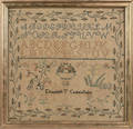
Schoolboy Map of Massachusetts, Rhode Island & Connecticut Bay, "Drawn by Daniel F. Draper 1831," Dedham, Massachusetts, watercolor, ink, and graphite on paper, with key below, (toning, small punctures along top and bottom edges), sight size 13 1/2 x 16 in., in a later frame. Provenance: A note dated 1923, affixed to the reverse, reads: "This map was drawn by David Fisher Draper, nine years old, living where he was born on his father's farm in West Dedham, Mass. He was the son of Deacon Martin Draper. The map came to his daughter Mary Draper Cobb and was given by her to her daughter Ruth December 25th 1923."


Skinner

Auctioneer:
Skinner

Date:
2011-08-14

Archived auctions similar to Schoolboy Map of Massachusetts Rhode Island & Connecticut Bay Down arrow


Sold for:
$1,968

Watercolor, Pen and Ink Schoolboy Map of the United Kingdom, Saxton B. Little, Columbia, Connecticut, c. 1828, hand-drawn map with watercolor borders depicting England, Scotland Read more…


Auctioneer:
Skinner

Date:
2015-08-09


Sold for:
$948

Schoolboy Map of United States/New England States, "By S. Webster Concord, N.H. 1820. M.F. White, Teacher," signed l.c., watercolor and ink on paper, (toning, minor Read more…


Auctioneer:
Skinner

Date:
2011-03-06


Sold for:
$100

Framed William M. Bradley & Bros. Map of Massachusetts, 1889, ht. 26 1/4, wd. 32 in. Estimate $150-200 Items may have wear and tear, imperfections, Read more…


Auctioneer:
Skinner

Date:
2020-01-15


Sold for:
$1,422

American School, 19th Century Three Works on Paper.D> An ink and watercolor schoolboy map inscribed "Map of the Great Lakes/Drawn By E. Read more…


Auctioneer:
Skinner

Date:
2012-03-04


Sold for:
$5,228

New England. Braddock Mead (c. 1688-1757) A Map of the Most Inhabited Part of New England Containing the Provinces of Massachusetts Bay and New Read more…


Auctioneer:
Skinner

Date:
2014-11-16


Sold for:
$523

North America, Canada. Thomas Bowen (d. 1790) A Map of the British and French Settlements in North America. London: Gentleman's Magazine of Arts & Sciences, Read more…


Auctioneer:
Skinner

Date:
2019-05-08


Sold for:
$480

New England. John Russell (c. 1750-1829) Map of the Northern or New England States of America . London: Symonds, 1795. Double page folio copper-plate Read more…


Auctioneer:
Skinner

Date:
2013-11-17


Sold for:
$1,476

New England. Braddock Mead (c. 1688-1757) A Map of the Most Inhabited Part of New England Containing the Provinces of Massachusetts Bay and New Hampshire, Read more…


Auctioneer:
Skinner

Date:
2017-11-12


Sold for:
$1,230

New England. Braddock Mead (c. 1688-1757) A Map of the Most Inhabited Part of New England Containing the Provinces of Massachusetts Bay and New Hampshire, Read more…


Auctioneer:
Skinner

Date:
2017-11-12


Sold for:
$2,706

New England. Braddock Mead (c. 1688-1757) A Map of the Most Inhabited Part of New England Containing the Provinces of Massachusetts Bay and New Read more…


Auctioneer:
Skinner

Date:
2016-05-18